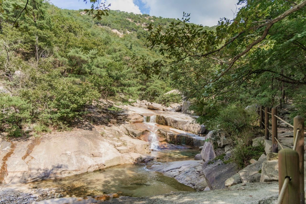
Bukhansan is a real national-park hike on Seoul's edge, not a paved city stroll.
Park entry is free. The useful question is which marked route fits your fitness, daylight, and weather, not whether every visitor should climb Baegundae.
Hours, closures, and rental rules change. Check KNPS and the Seoul Hiking Tourism Center on the day you hike.
At a glance
| Item | Detail (verify for your date) |
|---|---|
| Park | Bukhansan National Park (designated 1983) |
| Peak most visitors mean | Baegundae, about 836 m (VISITKOREA lists 835.6 m) |
| Entry fee | Free (parking is separate if you drive) |
| Best first-timer logistics | Ui Line to Bukhansan Ui Station, Exit 2 |
| Gear rental | Seoul Hiking Tourism Center (Bukhansan), near Exit 2 |
| Summit reality check | Final Baegundae rock uses fixed ropes/rails; not "easy" |
| Night hiking | Not allowed under park entry-time rules |
Quick facts
- Where
- Northern Seoul / Bukhansan National Park
- Time needed
- About 3 to 6 hours, route-dependent
- Cost
- Free entry; optional gear rental
- Best for
- Fit travelers who want a real Seoul mountain day
Is Bukhansan worth hiking?
Yes, if you want granite views, a clear fitness challenge, and a mountain day without leaving the capital region.
Skip Baegundae if you have no hiking experience, only sneakers, little daylight left, ice underfoot, or a fear of exposed rock. Choose a lower marked route, or pick an easier Seoul mountain from the Seoul subway hiking hub.
Route chooser (4 types, not every trail)
Bukhansan has many official courses. Foreign visitors usually need route types, not a full course dump.
Official grade means a published trail grade (Seoul Hiking Tourism Center / KNPS-style). Tripkopia planning is an editorial fit for a foreign visitor with city-trip shoes and daylight. "Beginner" on a brochure is not risk-free: rain, ice, heat, poor shoes, or a late start can make any route a bad idea.
| Route | Best for | Planning time |
|---|---|---|
| Baegundae via Ui | Strong hikers aiming for Seoul's high point | About 4 to 6 hours round trip |
| Yeongbong mid-mountain | Fit walkers who want views without the cable scramble | About 3 to 5 hours round trip |
| Bukhansanseong approach | History and scenery, longer day | Half day or more if aiming high |
| Sogwicheon / lower valley | Lower commitment, gentler valley walking | About 2 to 4 hours round trip |
Planning times are editorial round-trip buffers (rests and queues included). Official materials often publish one-way estimates. Your pace, crowds, and weather will differ. Do not treat app-only times as official KNPS figures.
Baegundae via Ui
- Start: Bukhansan Ui Station → walk or taxi to the Baegundae Visitor Center area
- Finish: Usually out-and-back
- Official grade: Seoul Hiking Center lists Advanced/Expert on the Baegundae Trail (about 4.1 km, est. 130 min one-way in their PDF)
- Tripkopia planning: Strenuous
- Summit: Yes (Baegundae)
- Caveat: Final ~0.3 km rock uses ropes/rails; turn around if unsure
Yeongbong mid-mountain
- Start: Same Ui logistics toward the Baegundae Visitor Center area
- Finish: Usually out-and-back or as published
- Official grade: Seoul Hiking Center Intermediate (about 4.3 km, est. 110 min one-way in their PDF)
- Tripkopia planning: Intermediate
- Summit: Yeongbong, not Baegundae
- Caveat: Still rocky and steep in places; not a paved stroll
Bukhansanseong approach
- Start: Line 3 Gupabal → bus to Bukhansanseong entrance / visitor center
- Finish: Out-and-back or longer loops
- Official grade: KNPS lists a Bukhansanseong course among marked options
- Tripkopia planning: Intermediate to strenuous if continued to Baegundae
- Summit: Optional
- Caveat: Station ≠ trailhead; confirm the bus stop and trailhead name
Sogwicheon / lower valley
- Start: Ui-side access near Hiking Tourism Center guidance
- Finish: Out-and-back on a marked valley path
- Official grade: Seoul Hiking Center Beginner (about 3.5 km, est. 100 min one-way in their PDF)
- Tripkopia planning: Beginner to easy-intermediate
- Summit: No
- Caveat: "Beginner" still needs decent shoes and daylight; not risk-free
Should you climb Baegundae?
Baegundae is Seoul's highest peak and the postcard goal many hikers name.
VISITKOREA lists the terrace at 835.6 m. Local materials often round near 836 m. Either way, elevation alone understates the finish.
The Seoul Hiking Tourism Center's Bukhansan materials grade the Baegundae trail Advanced/Expert and warn that from Baegunbongammun toward the peak you hold a rope and watch your step on rock. That final stretch is short on the map (about 0.3 km / roughly 20 minutes in their segment notes) and still the section that surprises visitors in sneakers.
Tripkopia planning call: treat Baegundae as a strenuous city-trip hike for reasonably fit people with hiking shoes on a dry day. It is not an easy Seoul hike, and it is not for everyone.
Turning around below the cable section is a normal, smart choice. Views lower on the mountain can still be excellent.
How to get there from central Seoul
Think in layers: subway station → short walk/bus/taxi → named trailhead. Do not assume one station serves every Bukhansan entrance.
Ui-side routes (most useful for first-timers)
- Ride the subway to the Ui Line terminus, Bukhansan Ui Station.
- Exit 2.
- Walk about 5 minutes to the Seoul Hiking Tourism Center (Bukhansan) if you need maps or gear.
- Continue on foot (often around 20 to 30 minutes toward the Baegundae Visitor Center area) or take a short taxi if you prefer.
Have your transit payment ready (T-money or mobile transit). Full recharge steps stay on the T-money guide.
Station-name trap: Bukhansan Ui Station (Ui Line) is not Bukhansan Station on Line 4. Searching only "Bukhansan" in a map app can send you to the wrong place.
Bukhansanseong-side routes
From Gupabal Station (Line 3), take the local bus toward the Bukhansanseong entrance / visitor-center area. Confirm the stop name on the bus screen or with a map app before you ride.
Other entrances exist
Jeongneung, Jingwansa / Eunpyeong-side approaches, and Dobong-side peaks are part of the wider park system. This guide focuses on the Ui and Bukhansanseong choices most foreign visitors use first. Dobongsan granite ridges are a separate, often harder decision and are not expanded here.
Seoul Hiking Tourism Center (Bukhansan)
The Bukhansan branch sits about a 5-minute walk from Bukhansan Ui Station, Exit 2 (address published as 5F, 52, Samyang-ro 173-gil, Gangbuk-gu).
Current official pattern to reconfirm before you go:
- Hours: about 09:00 to 18:00
- Closed: Mondays and listed holidays (the center site also flags New Year / Lunar New Year / Chuseok-style closures; check the live calendar)
- Phone: 1533-2608
Confirm live hours and rental details on the official Seoul Hiking Tourism Center page before you rely on them.
What it is useful for
- Multilingual course advice and printed materials
- Gear rental aimed at foreign tourists (and Koreans visiting with foreign friends, per the center's own note)
- Lockers, lounge, changing rooms; showers may be available if you bring personal toiletries
What to verify the morning of your hike
- Whether walk-in stock remains, or a reservation is wiser
- Exact rental fees and deposit rules
- Latest return deadline (commercial booking pages sometimes list mid-afternoon returns; do not invent a fee here)
- Whether crampons are advised that day
Renting gear does not make Baegundae easy. It only removes the "I packed sneakers" problem.
What to wear and bring
| Item | Why |
|---|---|
| Hiking shoes with grip | Granite and rock steps are slippery in sneakers |
| Gloves | Helpful on ropes, rails, and cold rock |
| Water and snacks | Refill points are limited on many stretches |
| Layers + light rain shell | Ridges are windier and colder than downtown |
| Phone with offline map / battery | Signage helps, but do not rely on one screenshot |
| Crampons in winter | Ice on granite is common; rent or buy when conditions require them |
Stay on marked trails only. This is not a climbing guide: no ropes technique, no Insubong climbing, no off-trail shortcuts.
Seasons and weather
- Spring: mild air and flowers on lower paths; still start early for any summit plan.
- Summer: heat, humidity, and sudden rain. Start early, carry extra water, and turn back in storms.
- Autumn: popular for foliage and clear views; weekends crowd fast. There is no reliable official 2026 foliage "exact peak day" forecast to invent here. Watch current KNPS / tourism notices closer to your dates.
- Winter: short daylight, ice on rock, and crampon needs. Entry cutoffs are earlier on the KNPS winter table.
Fine dust, fog, and high winds can erase views and raise risk even when the trail is open.
Safety rules that matter
- Entry-time control (입산시간지정제): KNPS sets trail-by-trail entry windows. For many Bukhansan control points, published windows are roughly 04:00 to 17:00 (Mar to Nov) and 04:00 to 16:00 (Dec to Feb). Confirm your exact trailhead on the KNPS entry-time page before you go.
- No night hiking. Work backward from the entry cutoff and sunset, not from a hopeful summit selfie time.
- Closures: as of early September 2026, KNPS listed Bukhansan (and Bukhansan-Dobong) under partial control. That status changes. Check the live KNPS control board the morning of your hike instead of trusting any article's frozen segment list.
- Weather turnaround: rain, ice, extreme heat, lightning, and whiteout fog are reasons to stop.
- Emergency: call 119 for mountain rescue in Korea.
- Park rules: day hiking culture, pack out trash, no smoking, and follow posted camping/cooking bans.
Solo hiking is common on busy weekends, but solo + ice + late start + cables is a poor mix. Tell someone your plan.
Bukhansan vs easier Seoul hikes
| If you want… | Choose… |
|---|---|
| Paved city views | Namsan |
| Gentle deck walking | Ansan Jarak-gil or similar easy options in the subway hiking hub |
| Short steep city wall views | Inwangsan |
| Real national-park granite, optional summit | Bukhansan (this guide) |
| Harder granite scrambling beyond Baegundae | Dobongsan (experienced hikers; separate planning) |
Common mistakes
- Calling Baegundae "easy" because it is inside Seoul
- Wearing sneakers on rock and cables
- Going to Bukhansan Station (Line 4) instead of Bukhansan Ui Station
- Confusing the subway station with the trailhead name
- Starting after lunch for a 4 to 6 hour round trip
- Treating "beginner" brochure language as risk-free
- Ignoring Monday Hiking Center closure when you planned to rent everything
- Pushing the cable section in rain or ice
- Leaving the marked trail for a "shortcut"
FAQ
Do I need hiking experience for Bukhansan? For lower valley routes, basic fitness and proper shoes may be enough on a dry day. For Baegundae, you should be comfortable on steep rock with fixed ropes and ready to turn around.
Can I rent hiking shoes near the mountain? Yes, at the Seoul Hiking Tourism Center near Bukhansan Ui Station Exit 2, when the center is open and stock remains. Confirm hours, fees, and return time officially.
Is Bukhansan free? Park entry is free. Budget separately for transit, optional gear rental, food, and parking if you drive.
How long does Baegundae take? Plan a round trip of about 4 to 6 hours including rests and queues, even when one-way brochure times look shorter. Start early.
Can I hike alone? Many people do on busy days. Solo is less wise in ice, storms, or on the final cable section if you are unsure. Share your plan and carry a charged phone.
When should I start? Before mid-morning is safer for summit plans. For a long Baegundae day, starting closer to opening time beats a noon departure.
Final takeaway
Pick the route type first, then the station and trailhead, then the gear and start time.
Baegundae is worth it for fit hikers on a dry day with proper shoes and enough daylight. Everyone else can still enjoy Bukhansan's forests and mid-mountain views on a lower marked path, or choose an easier Seoul mountain instead.
Verify KNPS closures, entry windows, and Hiking Center hours the morning you go.
Sources
- Korea National Park Service — Bukhansan National ParkOfficial government site
- Seoul Hiking Tourism Center (official)Official tourism site
- VISITKOREA — Bukhansan National Park (Seoul District)Official tourism site
- Visit KoreaOfficial tourism site
- Seoul Metropolitan Government Open DataOfficial government site
Information is compiled from official sources. Details such as prices, hours, and schedules can change. Confirm time-sensitive facts before you travel.
Last verified on
Related guides
Hiking in Seoul: Mountains You Can Reach by Subway, Trail Difficulty, and Korean Hiking Culture
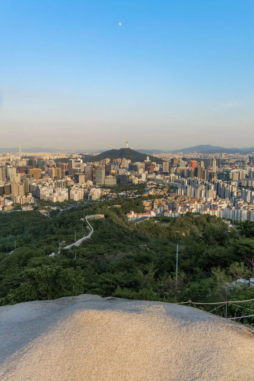
Seoul is ringed by dozens of hikeable mountains you can reach by subway with a T-money card, including Bukhansan, a Guinness-record national park inside the city. This guide helps you pick a mountain by difficulty (from a paved stroll up Namsan to the cabled granite scramble up Bukhansan's Baegundae), explains the confusing station names and access routes, covers gear rental, and lays out the safety rules and Korean hiking culture. Hiking has real risks, so don't underestimate difficulty, and check the official KNPS and Seoul Hiking Tourism Center info before you go.

T-money Card Guide for Visitors to Korea
A T-money card is a rechargeable transit card that works on subways, buses, and most taxis nationwide. Buy one at any convenience store or station machine for about ₩3,000 to 5,000, load cash onto it, and tap in and out. It is the simplest way for visitors to get around Korea.